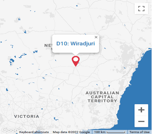
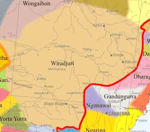
the wiradjuriof the first nations
Kamilaroi area is roughly bounded by Walgett, Goodooga, Mungindi, Goondiwindi, Ashford, Tamworth, Murrurundi and Coonabarabran. The lands stretch over 4,600 square miles (12,000 km2). Running southwest, they extended from the Birrie and Bokhara rivers to Brewarrina. The western frontier lay between the Culgoa and Birrie rivers.
northern nsw
Yuwaalayaay was recorded in the Goodooga - Narran river area. Its location is the area between the Barwon and Gwydir Rivers. The language once spoken in the central portion of this area from Walgett as far south as Willow Tree on the edge of the Great Dividing Range was traditionally spoken over a vast area of NSW.
It extended west of the Great Dividing Range from as far south as Murrurundi and the Page River, to Tamworth, Narrabri, Moree, Boggabilla, Mugindi, Collarenebri, Walgett and Gunnedah
The country was rather dry even over winter, which permitted a longer gathering and conservation of seeds as a food resource.