north america

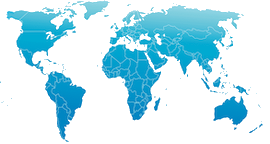
North America is a continent in the Northern and Western Hemispheres. It is bordered to the north by the Arctic Ocean, to the east by the Atlantic Ocean, to the southeast by the Caribbean Sea, and to the west and south by the Pacific Ocean.
time zones
New York
weather | living earth

Continental North America covers an area of about 24,709,000 square kilometers (9,540,000 square miles), representing approximately 16.5% of the Earth's land area and 4.8% of its total surface area.
North America is the third-largest continent by size, and the fourth-largest continent by population after Asia, Africa, and Europe.
As of 2021, North America's population was estimated as over 592 million people in 23 independent states, or about 7.5% of the world's population.
the living earth
north america
Greenland
overseas territories
 clipperton island
 saint pierre et miquelon
pacific time
mountain time
west north central time
east north central time
west south central time
east south central time
south atlantic time
middle atlantic time
new england time
caribbean time
pacific islands time
population
As of 2021, North America's population was estimated as over 592 million people in 23 independent states, or about 7.5% of the world's population.


